Explainer
Arizona’s Colorado River Cut: What It Really Means for Yuma
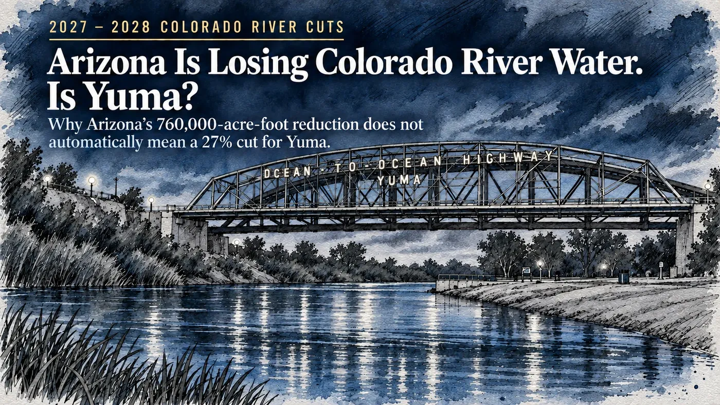
Arizona’s conditional 760,000-acre-foot share does not establish a uniform 27% cut to Yuma. Here is what the official records say about local priorities, planning and the decisions still unresolved.
Founder & Publisher
- Published
Full article
Arizona could lose 760,000 acre-feet of Colorado River water annually under the federal government’s new operating plan. That works out to roughly 27% of the state’s basic river allocation.
For Yuma, that number deserves attention. But it does not mean every farmer, water district, business or household in the area is facing a 27% cut.
The reason comes down to something Arizona has spent decades fighting over: water rights.
Yuma-area water users operate under different contracts, different legal priorities and different rules. Some hold rights that are senior to the Central Arizona Project (CAP). Others hold rights in the same general priority category as CAP.
And despite the federal government announcing its decision in August, Arizona’s own planning documents left one particularly important question unanswered: how much water would be available to on-river Priority 4 users?
The records reviewed by Yuma Informed support neither a blanket 27% reduction for Yuma nor a guarantee that local water deliveries will remain untouched.
Here is what the documents actually tell us.
Washington’s Decision and Arizona’s Share
On August 21, 2026, the Department of the Interior announced new Colorado River operating guidelines for 2027 and 2028. The plan calls for reducing the Lower Basin states’ annual water supply by 1.25 million acre-feet.
For perspective, an acre-foot is enough water to cover one acre of land to a depth of one foot. It is the standard unit used to measure large water supplies, particularly in agriculture.
Under the federal operating guidelines, the proposed annual reductions would be divided among the three Lower Basin states:
- Arizona: 760,000 acre-feet
- California: 440,000 acre-feet
- Nevada: 50,000 acre-feet
Together, those reductions total 1.25 million acre-feet.
There is a qualification buried in the paperwork that matters quite a bit.
Section 5.3.A of the guidelines ties that particular division of water reductions to the execution of implementing agreements. If the necessary agreements are not completed, the Secretary of the Interior determines the apportionment under applicable law.
The Lower Basin states submitted a proposal on May 1, but a proposal is not the same thing as a completed set of binding agreements.
Yuma Informed's review through September 22 did not establish that every required agreement had been executed. The 760,000-acre-foot figure therefore needs to be understood as the proposed Arizona share under that conditional arrangement.
The federal government also adopted a broader Record of Decision covering a 2027–2036 framework. The specific operating guidelines examined here govern 2027 and 2028. The broader decision framework does not settle every operational question for the years that follow.
Why the 27% Figure Can Be Misleading
Arizona's basic Colorado River apportionment is 2.8 million acre-feet.
Divide 760,000 by 2.8 million, and the result is approximately 27.14%.
The arithmetic is correct. The assumption that every Arizona water user must absorb that same percentage is not.
Colorado River water is distributed through a complicated system of legal entitlements and priorities. Those rights determine where different water users stand when supplies become limited.
Yuma is a geographic area, not a single water customer with one contract.
The City of Yuma, agricultural irrigation districts, tribal water users and neighboring municipalities hold different rights. Some rights cover the volume diverted from the river. Others concern consumptive use, meaning water that is consumed rather than returned to the river.
Those distinctions matter when officials determine who receives water and how much.
The Bureau of Reclamation's Arizona priority rules help explain why.
Priority 1 includes present perfected rights, a category of established rights recognized under the governing legal framework. Priority 2 covers certain earlier rights, while Priority 3 includes qualifying contracts dating from before September 30, 1968.
Reclamation treats Priorities 2 and 3 as coequal.
Priority 4 includes the Central Arizona Project contract and later on-river contracts. Its treatment involves proportional allocation provisions, subject to applicable law, regulations, decisions by the Secretary of the Interior and approved sharing agreements.
That creates an important distinction for Yuma.
Some local rights have stronger legal priority than CAP. Others fall into Priority 4, where the relationship is considerably less straightforward.
Anyone claiming that all Yuma water automatically comes ahead of CAP is skipping over part of the federal government's own priority system.
Who Holds Yuma’s Colorado River Water?
The Bureau of Reclamation maintains separate entitlement lists for Arizona's water users. Those records provide a more useful picture of Yuma's position than a statewide percentage.
They also reveal how easily the numbers can be misunderstood.
Yuma County Water Users’ Association
The association appears on Reclamation's Priority 1 entitlement list with 254,200 acre-feet of annual diversion under Present Perfected Right No. 4.
It also appears on the Priority 3 list, but that entry does not specify an additional quantity.
That distinction prevents treating the second listing as some unknown amount of extra water.
Wellton-Mohawk Irrigation and Drainage District
Wellton-Mohawk appears under Priority 3 with an annual entitlement of 278,000 acre-feet of consumptive use.
That figure describes consumptive use, not the total volume diverted from the river. Those are different measurements and should not be used interchangeably.
Source: Reclamation Priority 3 entitlements
Yuma Mesa Division
The Yuma Mesa Division has a combined Priority 3 entitlement of 250,000 acre-feet of annual consumptive use.
That total is distributed among three districts: 41,203 acre-feet for North Gila Valley Irrigation District, 67,278 for Yuma Irrigation District and 141,519 for Yuma Mesa Irrigation and Drainage District.
Those three figures add up to 250,000 acre-feet. They are portions of the same entitlement, not additional water on top of it.
North Gila Valley also holds a separate Priority 1 entry covering 24,500 acre-feet of diversion.
The entries appear in Reclamation's Priority 1 and Priority 3 records.
City of Yuma
The City's water rights illustrate why reading only one line in the federal records can produce the wrong conclusion.
Its Priority 1 entry lists 1,478 acre-feet of consumptive use and 2,333 acre-feet of diversion, subject to a limiting footnote in the entitlement document.
A Priority 3 entry provides the balance needed to reach a combined annual consumptive-use entitlement of 50,000 acre-feet.
The City's legal entitlement is not 50,000 plus 1,478. The smaller amount is already included in the combined total.
Those figures are documented in Reclamation's Priority 1 and Priority 3 lists.
Yuma Auxiliary Project
The Yuma Auxiliary Project, also identified as Unit B, has a Priority 1 entry for 6,800 acre-feet of diversion.
Its Priority 3 entry describes the diversion reasonably necessary to irrigate 3,305 acres.
There is a small but important difference between those numbers. An acre measures land. An acre-foot measures water volume. The 3,305-acre figure cannot be treated as an additional 3,305 acre-feet of water.
The entitlement records also use the Yuma Auxiliary Project name, while federal accounting documents refer to a Unit B district. Those descriptions should not automatically be treated as identical legal entries without examining the underlying records.
Priority 1 records | Priority 3 records | Federal accounting schedules
Cocopah Water Rights
Cocopah-related entries appear under more than one priority.
Reclamation's Priority 1 list includes separate diversion entries of 7,681 and 1,140 acre-feet. The Priority 4 list includes another 2,026 acre-feet of diversion and cross-references the Priority 1 entries.
This is particularly relevant because Arizona's preliminary shortage presentation assigns a percentage to CAP Indian Priority water.
That percentage should not be mistaken for a specific reduction in Cocopah water rights.
The federal entries establish that different Cocopah-related rights have different listed priorities. They do not establish the complete scope of tribal holdings or a final allocation for the Tribe.
Priority 1 entries | Priority 4 entries
City of Somerton
Somerton appears on the Priority 4 list with an entitlement of 750 acre-feet of annual diversion under contract 03-XX-30-W0419.
That entry identifies an entitlement. It does not establish how much water Somerton currently uses or what its 2027 delivery will be.
Source: Reclamation Priority 4 entitlements
There is another geographic wrinkle worth remembering.
The federal Yuma Project extends into California.
According to Reclamation's project description, it covers 68,091 acres, including 53,415 acres in Arizona's Valley Division and 14,676 acres in California's Reservation Division.
Those figures describe the project, not necessarily the acreage currently planted.
The name Yuma Project does not mean every acre or every water entitlement associated with it belongs to Arizona.
Taken together, these records show why applying a single statewide shortage percentage to the Yuma area produces an unreliable answer.
They are also not a complete legal inventory. The reviewed entitlement lists carried revision dates ranging from August 2024 to December 2025, and the records examined through September 22, 2026, do not rule out subsequent amendments.
Water Rights Are Not the Same as Water Deliveries
A water entitlement establishes a legal right. It does not necessarily tell us how much water will actually be delivered in a particular year.
Reclamation's annual accounting records distinguish between approved diversions, forecast diversions and forecast consumptive use.
The City's own numbers offer a useful example.
In the 2026 Colorado River water forecast dated September 21, Reclamation listed these figures for the City of Yuma:
- Approved diversion: 32,600 acre-feet
- Forecast diversion: 31,242 acre-feet
- Forecast consumptive use: 18,646 acre-feet
All three describe different aspects of the same year's water operations.
None replaces the City's combined 50,000-acre-foot legal consumptive-use entitlement. Nor does any of them establish how much the City will receive in 2027.
The September forecast was provisional, with monthly use-to-date figures updated through July.
This is where comparing water numbers without checking what they measure can lead readers badly astray.
An entitlement, an approved annual diversion and a forecast are three different things. Even two numbers expressed in acre-feet may be measuring different aspects of the water supply.
Arizona's Own Planning Documents Leave a Major Question Open
On August 24, the Arizona Reconsultation Committee presented an illustrative shortage scenario for 2027.
Slide 39 of the presentation outlined several proposed shortage levels for Central Arizona Project water.
The CAP Agricultural Pool and CAP Non-Indian Agricultural Priority categories were shown with 100% shortages.
CAP Municipal and Industrial Priority was shown at 14%, while CAP Indian Priority was shown at 10%.
Then came the entry especially relevant to Yuma's on-river users.
On-river Priority 4: TBD.
To be determined.
That leaves a substantial unanswered question for an area whose water users include Priority 4 entitlement holders.
The presentation was explicitly preliminary and illustrative. Those percentages were planning assumptions, not final delivery notices to individual customers, districts or tribes.
The 10% CAP Indian Priority figure, for example, cannot be applied to Cocopah's listed entitlements simply because both concern tribal water.
Likewise, the document does not establish that all on-river Priority 4 users will face the same treatment as CAP.
When Yuma Informed checked the committee's public records on September 22, the August 24 meeting was still the latest listed. The review did not identify a later final determination for on-river Priority 4 users.
Nor did it establish individual 2027 delivery orders for Yuma-area water holders. The federal accounting index examined contained 2026 schedules and approvals.
That does not prove the missing decisions or documents do not exist. It means the reviewed records did not establish them.
For farmers, water districts and municipalities trying to prepare for 2027, the distinction matters.
Planning percentages can indicate where officials expect shortages to fall. Actual delivery orders and governing agreements establish what an individual water user is authorized to receive.
Will the Central Arizona Project Take the Biggest Hit?
Arizona's priority system gives some Yuma-area users a stronger position than CAP, and the state's preliminary scenario shows severe shortages for certain CAP categories.
That provides a reasonable basis for expecting important differences between CAP deliveries and deliveries under some senior on-river rights.
But it does not establish that CAP will absorb Arizona's entire proposed reduction.
Priority 4 includes both CAP and later on-river contracts. How those rights are treated depends on the applicable legal framework, federal decisions and any approved sharing arrangements.
Reservoir conditions, future operating decisions and litigation could also affect the outcome.
There is a meaningful difference between saying some Yuma water rights have senior priority and promising that Yuma is protected from reductions.
The first statement is supported by the federal entitlement records.
The second goes further than the available evidence allows.
Another 700,000 Acre-Feet Through Conservation
Water shortages are only part of the federal plan.
Section 5.3.B of the 2027–2028 operating guidelines provides for an additional 700,000 acre-feet of voluntary conservation across 2026, 2027 and 2028.
That is 700,000 acre-feet over the three-year period, not 700,000 acre-feet annually.
Voluntary conservation is different from a mandatory shortage. It involves agreements under which participating water contractors conserve water according to negotiated terms.
The May 1 Lower Basin proposal discusses minimum conservation contributions of 300,000 acre-feet each from Arizona and California and 100,000 from Nevada, dependent on appropriate funding.
Those state-level figures do not tell an individual Yuma farmer or district whether participation will be required, offered or financially worthwhile.
The practical questions are considerably more specific.
Will a particular district participate? What conservation measures would be required? Would growers receive compensation? How would the saved water be measured and verified? And when would any agreement take effect?
The records examined did not establish participation by specific Yuma water users in the new 700,000-acre-foot program.
Existing conservation figures in the 2026 federal forecast do not answer that question either.
For Yuma agriculture, the difference between a compulsory shortage and a compensated conservation agreement could be substantial. The governing terms would matter as much as the volume of water involved.
Mexico Has a Separate Agreement
The Colorado River does not stop at the international border, and neither do the negotiations.
On September 2, the United States and Mexico signed Minute 334, a new binational agreement addressing Colorado River cooperation through December 31, 2028.
Both governments approved it on September 8.
According to Reclamation's September 9 announcement, the agreement concerns water-use reductions, salinity and evaluation of additional water sources.
The agreement, available through the International Boundary and Water Commission, is separate from the Lower Basin states' proposed sharing arrangement.
Mexico is not one of the three U.S. Lower Basin states.
Its treaty-related obligations should therefore not be added to Arizona's proposed 760,000-acre-foot reduction or treated as another portion of Arizona's allocation.
The agreement adds another piece to the broader Colorado River picture, but it operates through a different legal and governmental framework.
Why Yuma City Council Is Considering Legal Action
Yuma officials have already taken steps to protect what the City considers its water rights.
On September 16, the Yuma City Council passed motion MC 2026-173, authorizing exploration of possible legal action concerning the federal government's August operating decision.
The Council report sets out the City's objections to how the decision treats Lower Basin water users and explains its position on relative priority rights.
The authorization allows the City to explore litigation, retain legal counsel and potentially participate in a court challenge.
It does not establish that litigation has been filed.
Nor does it mean a court has accepted the City's interpretation of federal water law.
Those are the City's legal arguments, which could eventually become issues for judicial consideration.
The report carries administrative signatures dated September 9. The Council's actual action occurred September 16, when the motion passed.
Yuma Informed's review did not verify a subsequent City-specific court filing.
That distinction matters because authorizing litigation and pursuing a case are separate events. A court ruling would be another step beyond either one.
What Yuma Still Needs to Know
The federal government's August decision established a major change in Colorado River operations for 2027 and 2028.
It did not establish a uniform reduction for every Yuma-area water user.
The available records identify senior local rights, shared entitlements, Priority 4 contracts and planning assumptions that could affect users differently.
Several details remained unresolved in the records reviewed through September 22.
Among them were whether every required Lower Basin implementing agreement had been executed, how on-river Priority 4 rights would ultimately be treated, what individual Yuma-area delivery orders would authorize for 2027, and which local water users might participate in the new voluntary conservation program.
Any later litigation filings, federal orders, reservoir determinations or changes to entitlement records could also affect the picture.
Those are specific gaps in the available evidence. They are not proof that no additional decisions have been made.
The next documents worth examining are the actual implementing agreements, final priority determinations and individual delivery orders. Those will tell Yuma water users considerably more than a statewide percentage.
For now, the 27% figure describes the size of Arizona's proposed reduction compared with its basic Colorado River apportionment. It does not establish a 27% cut to every Yuma water user.
Yuma's senior rights matter. So do its Priority 4 contracts, the final federal decisions and the agreements that put those decisions into practice.
Until those pieces are established, promising that Yuma will lose 27% is unsupported. Promising that Yuma will lose nothing is equally unsupported.
And with the Colorado River facing another round of difficult decisions, neither assumption is a sound basis for planning.
Sources and Review Date
Last reviewed: September 22, 2026.
This article is based on official records examined September 21–22, 2026. It does not represent a new verification of subsequent agreements, delivery orders or litigation developments.
Principal documents include:
- Department of the Interior's August 21 announcement
- Final 2027–2028 Colorado River Operating Guidelines, particularly Sections 5.3.A and 5.3.B
- Federal Record of Decision
- Arizona Reconsultation Committee's August 24 presentation, particularly Slide 39
- Arizona's Colorado River water priority rules
- Reclamation's Priority 1, Priority 3 and Priority 4 entitlement lists
- Reclamation's September 21, 2026 water forecast
- International Boundary and Water Commission Minute 334
- Yuma City Council motion MC 2026-173
These records document the entitlements, proposed operating arrangements and government actions described above. They do not, by themselves, establish final 2027 delivery quantities for individual Yuma-area water users.
Related claims 16
- VerifiedA listed entitlement, an approved annual diversion, a forecast diversion and forecast consumptive use describe different quantities.
A listed entitlement, an approved annual diversion, a forecast diversion and forecast consumptive use describe different quantities.
- Mostly SupportedArizona’s approximately 27% statewide calculation does not establish an across-the-board 27% cut to Yuma.
Arizona’s approximately 27% statewide calculation does not establish an across-the-board 27% cut to Yuma.
- VerifiedArizona’s August 24, 2026 preliminary planning presentation left on-river Priority 4 shortages TBD.
Arizona’s August 24, 2026 preliminary planning presentation left on-river Priority 4 shortages TBD.
- VerifiedMinute 334 establishes U.S.–Mexico Colorado River cooperative measures through December 31, 2028.
Minute 334 establishes U.S.–Mexico Colorado River cooperative measures through December 31, 2028.
- VerifiedOn September 16, 2026, Yuma authorized potential legal action concerning the federal Colorado River decision.
On September 16, 2026, Yuma authorized potential legal action concerning the federal Colorado River decision.
- VerifiedReclamation describes the Yuma Project as 68,091 acres spanning Arizona and California.
Reclamation describes the Yuma Project as 68,091 acres spanning Arizona and California.
View 10 more related claims
- VerifiedReclamation lists the City of Somerton with a 750-acre-foot annual Priority 4 diversion entitlement.
Reclamation lists the City of Somerton with a 750-acre-foot annual Priority 4 diversion entitlement.
- VerifiedReclamation lists Wellton-Mohawk with 278,000 acre-feet annually of Priority 3 consumptive use.
Reclamation lists Wellton-Mohawk with 278,000 acre-feet annually of Priority 3 consumptive use.
- VerifiedReclamation lists Yuma County Water Users’ Association under both Priority 1 and Priority 3.
Reclamation lists Yuma County Water Users’ Association under both Priority 1 and Priority 3.
- VerifiedReclamation’s lists include both Priority 1 and Priority 4 Cocopah entries.
Reclamation’s lists include both Priority 1 and Priority 4 Cocopah entries.
- VerifiedReclamation’s Yuma Auxiliary Project (Unit B) entries include Priority 1 and Priority 3 rights.
Reclamation’s Yuma Auxiliary Project (Unit B) entries include Priority 1 and Priority 3 rights.
- VerifiedThe Arizona 760,000-acre-foot share is conditional on the required implementing agreements.
The Arizona 760,000-acre-foot share is conditional on the required implementing agreements.
- VerifiedThe City of Yuma’s listed water entitlement combines Priority 1 and Priority 3, totaling 50,000 acre-feet annually of consumptive use.
The City of Yuma’s listed water entitlement combines Priority 1 and Priority 3, totaling 50,000 acre-feet annually of consumptive use.
- VerifiedThe federal 2027–2028 guidelines set an annual Lower Basin reduction of 1.25 million acre-feet.
The federal 2027–2028 guidelines set an annual Lower Basin reduction of 1.25 million acre-feet.
- VerifiedThe guidelines specify 700,000 acre-feet of additional voluntary conservation in total across 2026–2028.
The guidelines specify 700,000 acre-feet of additional voluntary conservation in total across 2026–2028.
- VerifiedThe listed Yuma Mesa Division Priority 3 consumptive-use entitlement totals 250,000 acre-feet across three districts.
The listed Yuma Mesa Division Priority 3 consumptive-use entitlement totals 250,000 acre-feet across three districts.
Sources 20
- Primary source · Government recordADWR: Arizona Reconsultation Committee meeting index
Checked September 22, 2026: newest meeting listed is August 24, 2026. This bounded check does not prove no newer treatment exists elsewhere.
- Primary source · Meeting recordADWR/CAWCD, August 24 Arizona Reconsultation Committee presentation
Slides 22–23 and 39–40. This presentation reflects preliminary government planning and legal positions. Its shortage figures are illustrative and should not be treated as final individual allocations.
- Primary source · Meeting recordCity of Yuma, MC 2026-173, legislation details and report
Status, final-action date, motion scope, staff report, and administrative review dates. Rechecked September 22, 2026: Passed, final action September 16. City legal arguments are attributed advocacy, not judicial findings. The separate Queen Creek transfer dispute is not this motion.
- Primary source · Meeting recordCity of Yuma, September 16 meeting details
Agenda listing; final minutes and action detail unavailable in this view when reviewed.
- Primary source · Public statementDepartment of the Interior, August 21 operating-decision announcement
Supports the announcement date, aggregate reduction and conditional state allocation. The announcement should be read together with the final operating guidelines, which provide the operative details for the conservation period.
- Primary source · Government recordIBWC, Minutes archive
Minute 334 entry: signing and both government approval dates.
View 14 more sources
- Primary source · Government recordIBWC, official Minute 334
PDF p. 1: signing date and term. This is a scanned official document. The cited provision was verified visually in the official copy.
- Primary source · Government recordLower Division States, May 1 proposal, hosted by ADWR
p. 1 term and state shares; p. 4 conservation and funding; p. 7 reservations. A proposal, not proof of executed implementing agreements.
- Primary source · Government recordReclamation, Arizona 2026 schedules, revisions, and approvals
Index located; individual approval records were not comprehensively audited.
- Primary source · Government recordReclamation, Arizona Priority 1 list
Retained September 22, 2026; heading September 2025. Pages 1–3 visually checked against text from the same file. The entitlement list distinguishes diversion quantities from consumptive-use quantities and includes limiting PPR footnotes. Those quantities should not be combined as though they measure the same thing. Not a certification against all later amendments.
- Primary source · Government recordReclamation, Arizona Priority 3 list
Retained September 22, 2026; heading August 2024. Pages 1 and 3 visually checked against text from the same file. District shares total 250,000 AF CU; Unit B is acreage-based; City total is 50,000 AF CU including its PPR component.
- Primary source · Government recordReclamation, Arizona Priority 4 list
Retained September 22, 2026; heading December 2025. Text and rendered pages agree: Somerton 750 AF diversion on page 3; Cocopah 2,026 AF diversion on page 4, with PPR cross-references. The retained official PDF was checked visually against its extracted text for these entries. Later amendments remain outside the scope of this snapshot.
- Primary source · Government recordReclamation, Arizona priority description
p. 1 priority classes and qualifications.
- Primary source · Government recordReclamation, Colorado River entitlement index
Entry point for Arizona priority and entitlement records.
- Primary source · Government recordReclamation, current-link CY2026 forecast PDF
Official current-link PDF retained September 22, 2026. Report stamp: September 21, 2026, 11:44:47 AM (timezone not stated). Same-file text and rendered Arizona pages 2–3 agree. CY2026 City of Yuma approved diversion 32,600 AF; forecast diversion 31,242 AF; forecast use 18,646 AF. Use-to-date is updated through July for monthly reporters and estimated for annual reporters; forecast is provisional, not final actual use or a 2027 order. The URL can change.
- Primary source · Government recordReclamation, final 2027–2028 operating guidelines
§3 printed p. 2; §5.3.A printed p. 7/PDF p. 8; §5.3.B printed p. 8/PDF p. 9; §5.9 printed p. 15.
- Primary source · Government recordReclamation, final Record of Decision
Opening decision-framework discussion. Official decision index: https://www.usbr.gov/ColoradoRiverBasin/post2026/
- Primary source · Government recordReclamation, official water-accounting index
This Source uses Reclamation's official water-accounting forecast link. The forecast is a dated operational snapshot and may be revised as newer accounting data becomes available. The linked forecast was retained September 22, 2026, with a report stamp of September 21, 2026, 11:44:47 AM (timezone not stated). It is provisional, not final actual use or a 2027 order; the current-link PDF may change.
- Primary source · Public statementReclamation, September 9 U.S.–Mexico agreement announcement
Additional official announcement and bundled material: https://www.ibwc.gov/wp-content/uploads/2026/09/US-and-Mexico-announce-Colorado-River-cooperative-agreement.pdf
- Primary source · Government recordReclamation, Yuma Project
General section: acreage and state/division breakdown.
Timeline events 6
- Lower Division States date their short-term operations proposal
The proposal dated May 1 describes a 2026–2028 implementation term, proposed state shares and conservation contingent on funding. This is the document date, not a verified website publication time or executed agreement.
- Interior issues Colorado River decision framework and 2027–2028 guidelines
Interior announces the federal decision, including an annual 1.25-million-acre-foot Lower Basin reduction for 2027 and 2028. The state split remains tied to implementing agreements. The broader decision framework covers 2027–2036.
- Arizona presents preliminary 2027 shortage analysis
The Arizona Reconsultation Committee presentation gives illustrative CAP shortage percentages and leaves on-river Priority 4 TBD. It is planning material, not final user delivery orders.
- United States and Mexico sign Minute 334
Minute 334 is signed in El Paso, Texas. It addresses Colorado River cooperative measures through December 31, 2028, separately from the Lower Basin state-sharing arrangement.
- Both governments approve Minute 334
The IBWC archive records approval by the United States and Mexican governments on September 8, 2026. Approval follows the September 2 signing.
- Yuma authorizes potential Colorado River legal action
MC 2026-173 is marked Passed on September 16. It authorizes the City Attorney’s Office to explore legal action, retain counsel and potentially enter litigation. It does not establish a filed City lawsuit.
Source documents 1
- CY2026 water-use forecast: September 21, 2026 snapshot
Exact official PDF retained September 22, 2026. Official current-link PDF retained September 22, 2026. Report stamp: September 21, 2026, 11:44:47 AM (timezone not stated). Same-file text and rendered Arizona pages 2–3 agree. CY2026 City of Yuma approved diversion 32,600 AF; forecast diversion 31,242 AF; forecast use 18,646 AF. Use-to-date is updated through July for monthly reporters and estimated for annual reporters; forecast is provisional, not final actual use or a 2027 order. The URL can change.
Related topics 1
- Colorado River Water & Yuma
What federal Colorado River reductions mean for Yuma-area water holders, with evidence on priorities, planning, conservation and unresolved delivery decisions.